

Data availability
Products
With the exception of Level 1 - Raw product NRT COST-716 format tropospheric parameters, which are available up to the previous day, all other Level 1 to 3 products shown as in production, are currently available for the period up to 2015-09-30 only.
Station network maps
BIGF 30s and 1Hz station networks, comprising: OSGB, OSGB GeoNet sub-network, Leica Geosystems, OSi, OSNI and the Scientific networks.
1Hz data and metadata
Available for OSGB stations from 2009-08-28, and progressively for a sub-set of scientific stations, from 2009-01-28.
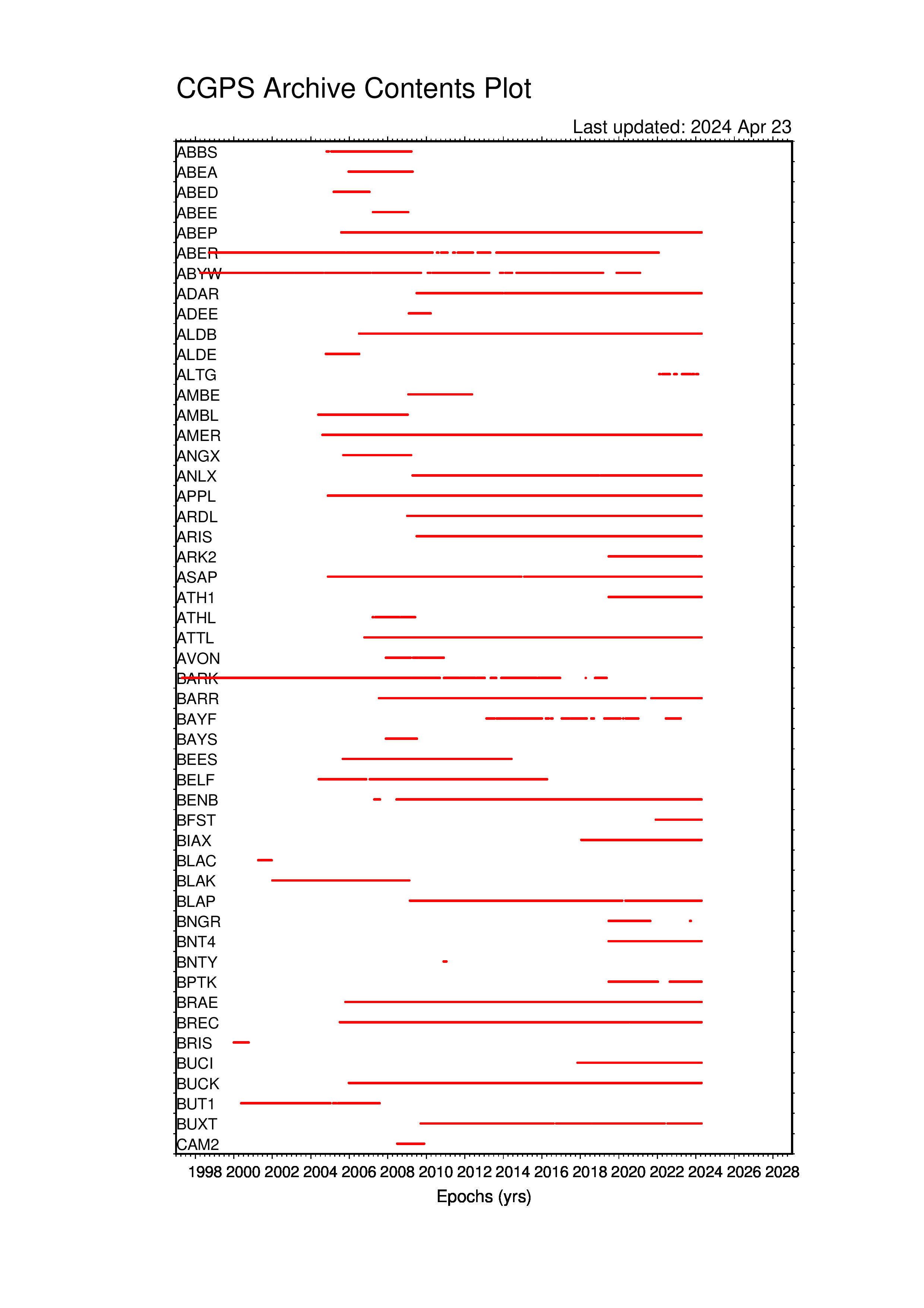
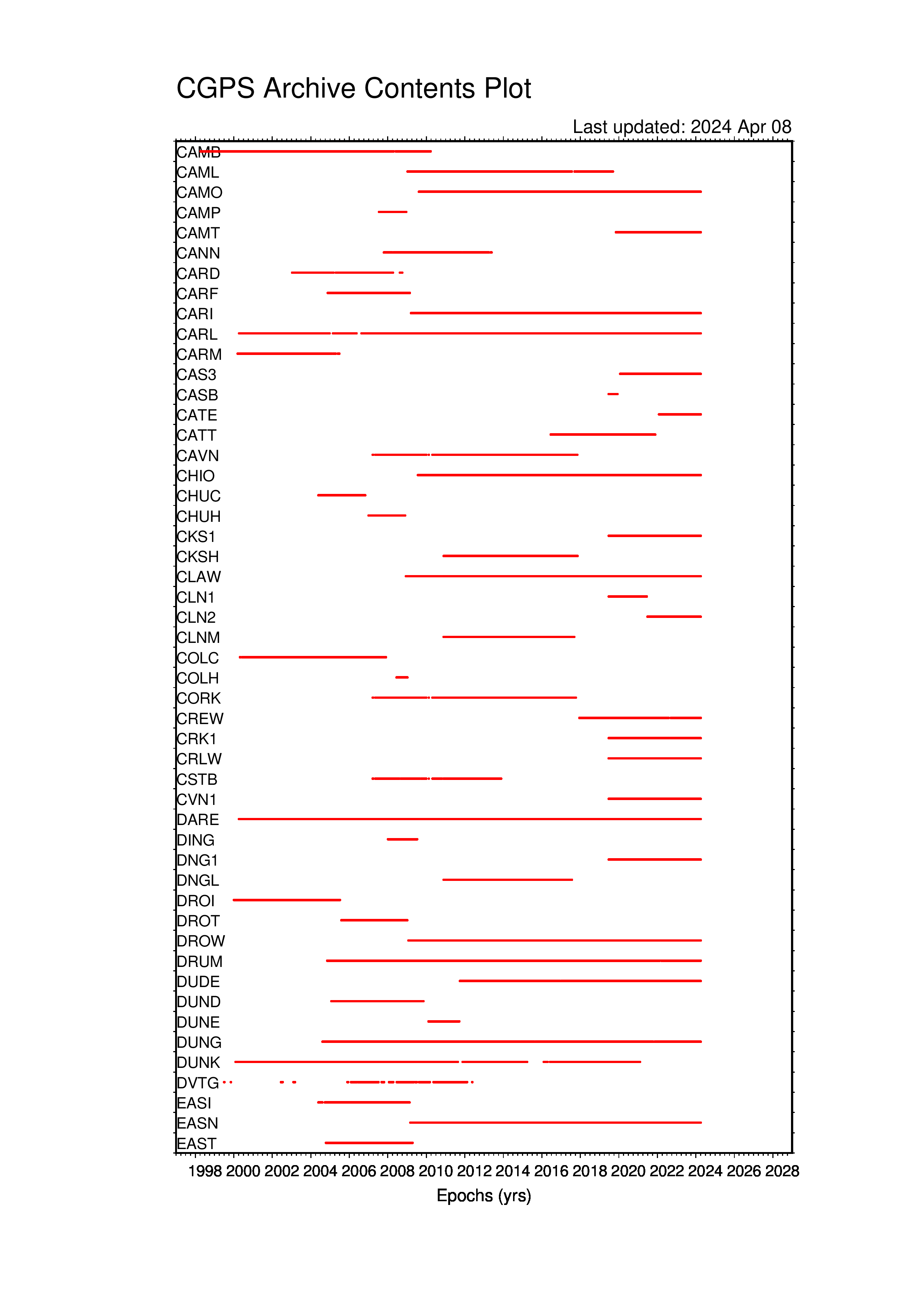
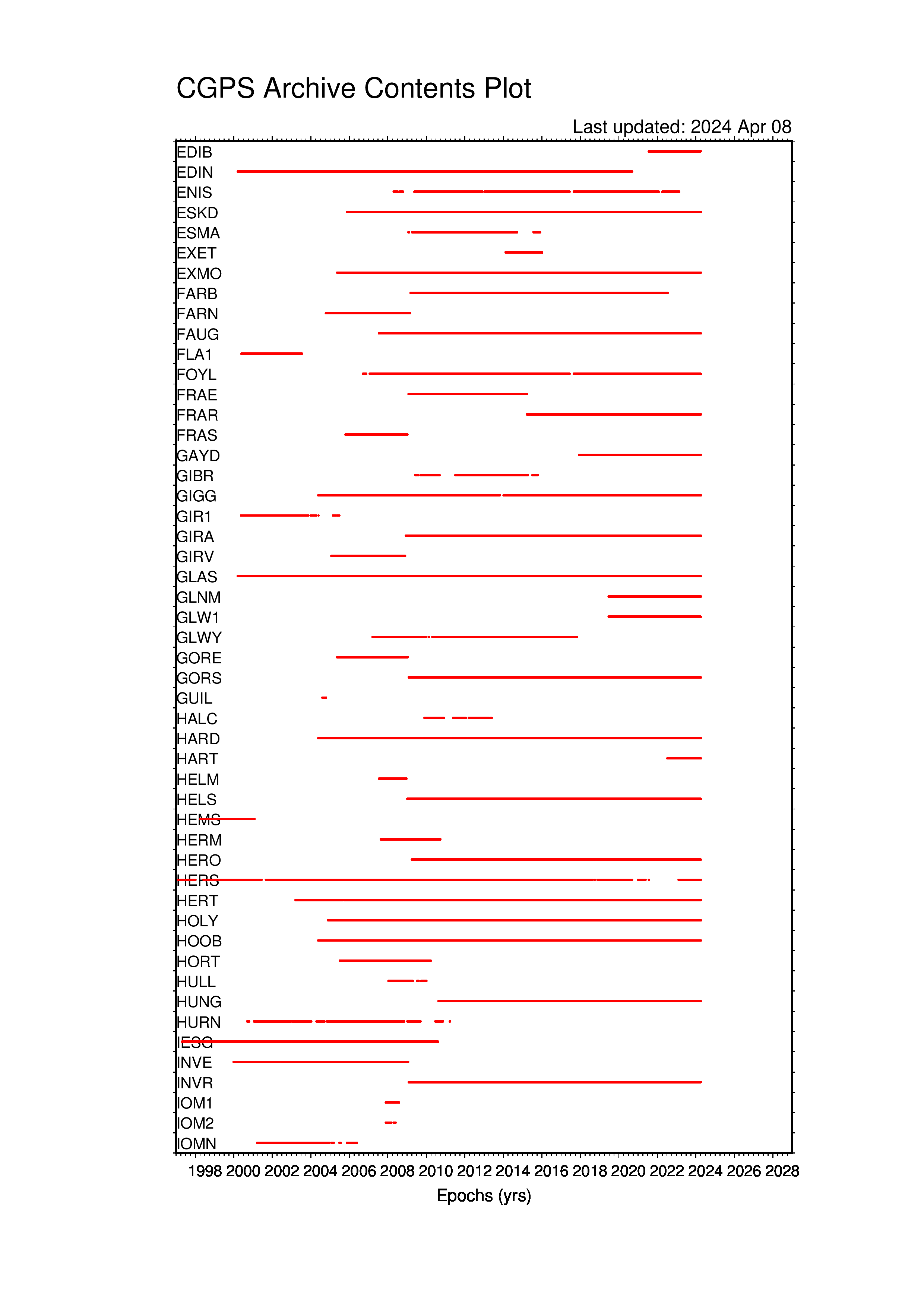
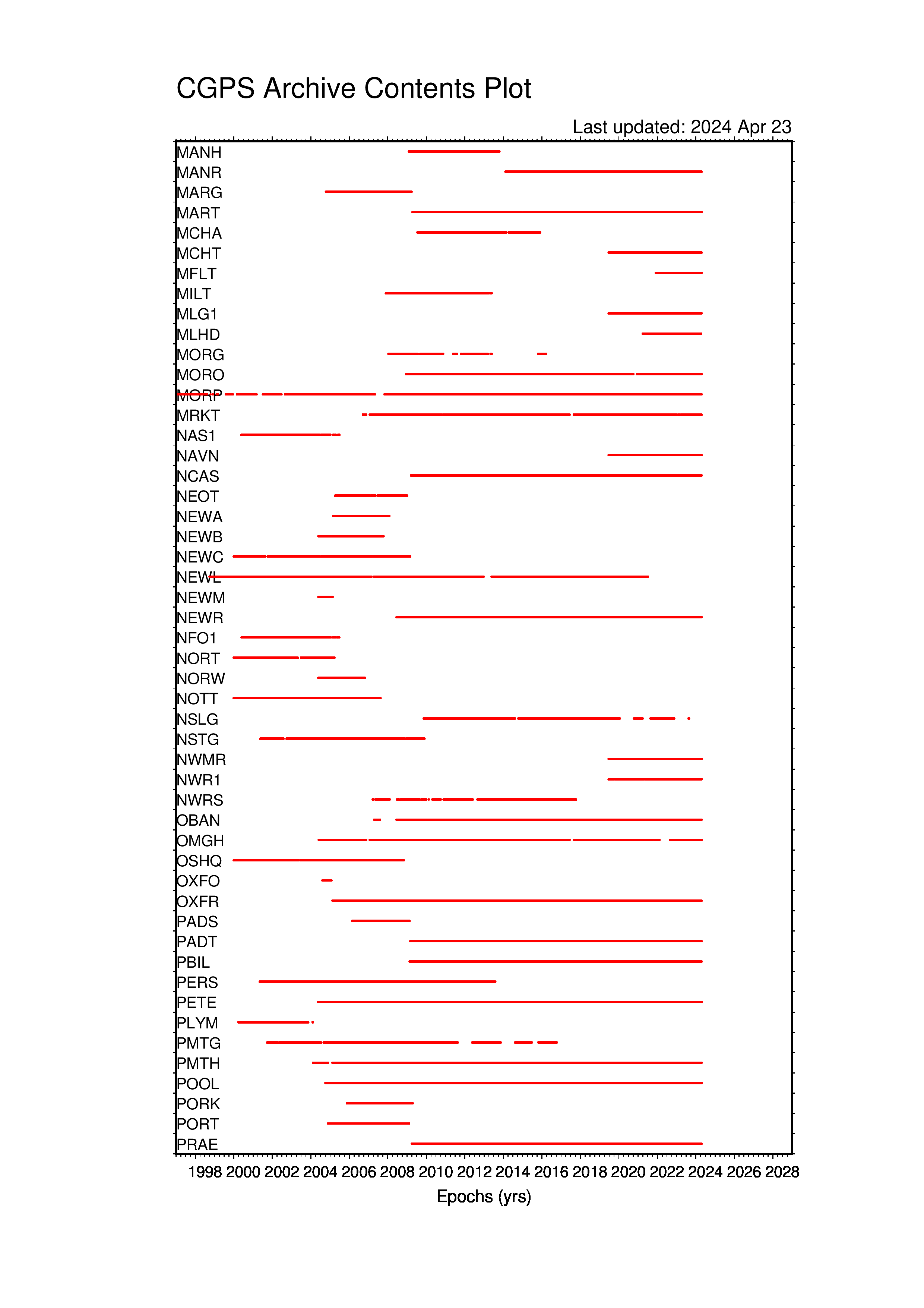
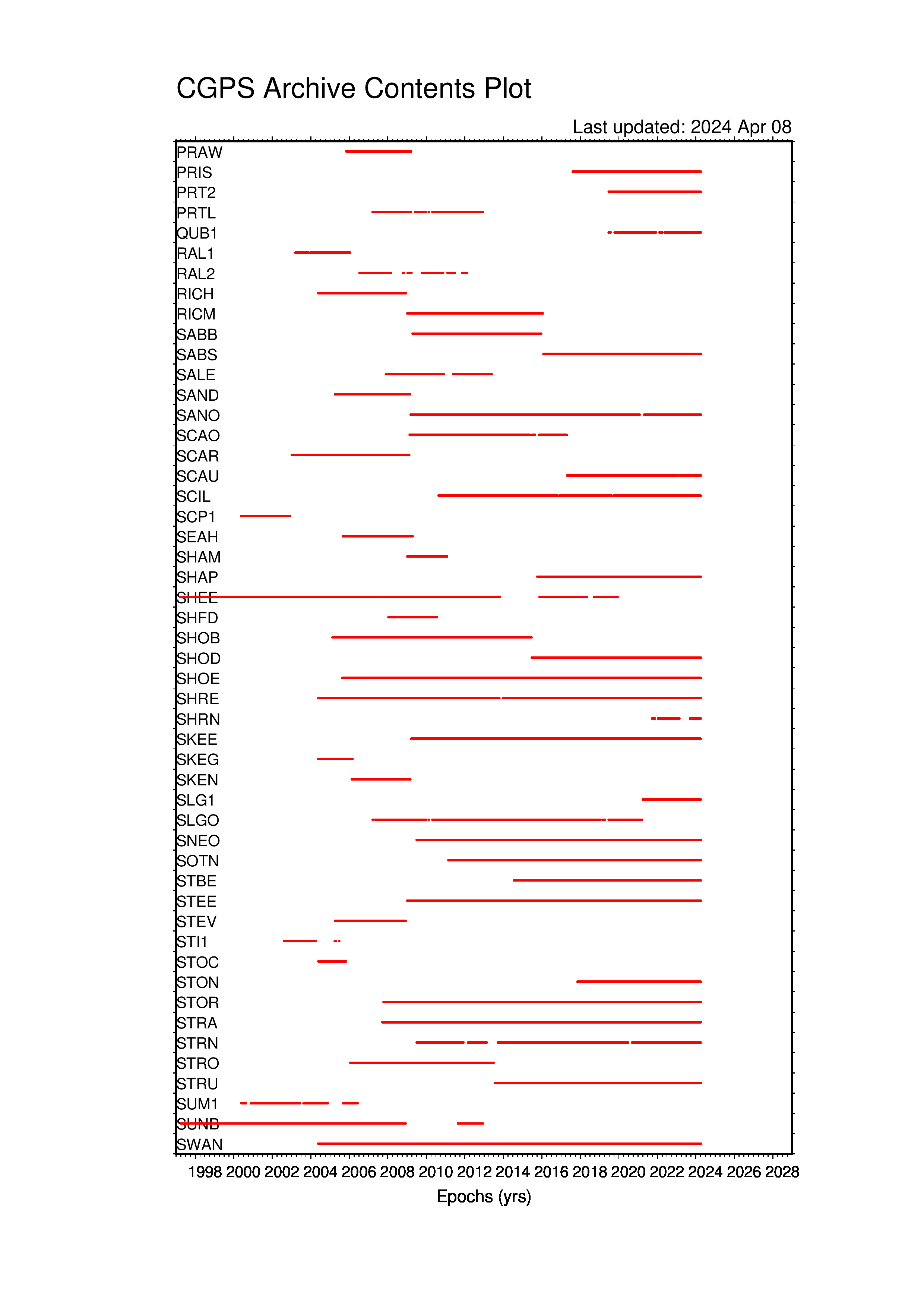
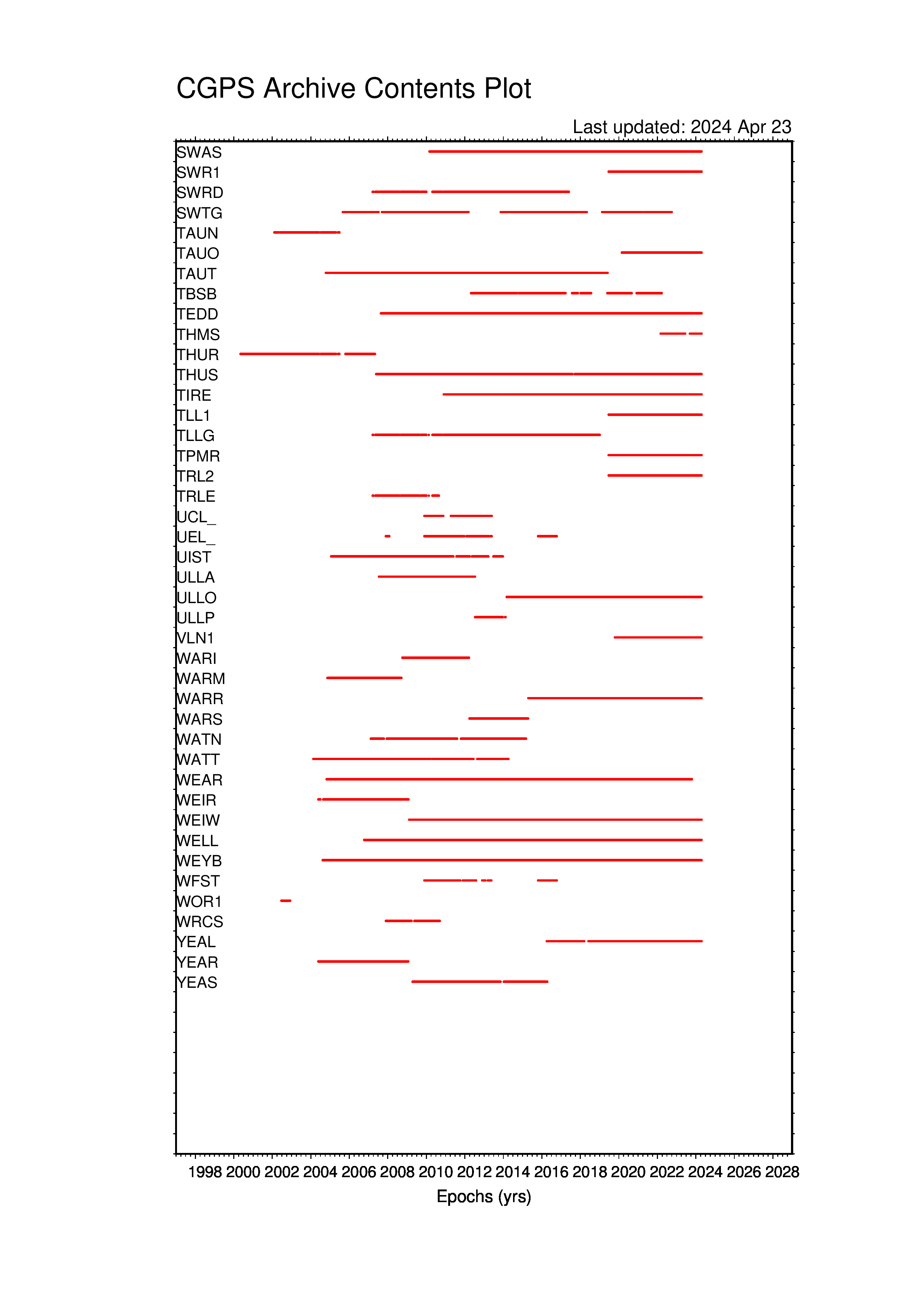
Long term data, at a glance, updated monthly
As graphic time series, alphabetically, from 1997-01-01 to date:
abbs-camb, caml-edin, enis-kels, keyw-mart, mcha-prtl, qub1-taun, tauo-yeas
Daily data, updated daily
Data availability table of all active stations by month at a resolution of one day. The abbreviations DOM and DOY at the top and bottom of the table stand for the day of the month and the day of the year. The first column lists four character station names. A blank cell indicates that the station is not yet operating, or has ceased operating. A dot indicates an operational station, but without a daily RINEX observation file for that day. An integer 0 to 9 indicates the completeness of the daily RINEX observation file, as a corresponding percentage from 0 to 100% according to this scale:
| 0 | 1 | 2 | 3 | ... | 8 | 9 |
|---|---|---|---|---|---|---|
| 0 < Obs[%] <= 10 * | 10 < Obs[%] <= 20 | 20 < Obs[%] <= 30 | 30 < Obs[%] <= 40 | ... | 80 < Obs[%] <= 90 | 90 < Obs[%] <= 100 |
| * or the percentage was not correctly determined | ||||||